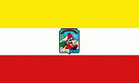
La Unión (La Unión)
 |
 |
It is the capital city of the department of La Unión. It is the largest city in the department with a population of approximately 34,000 inhabitants. Previously known as Puerto San Carlos, it was renamed La Unión on July 13, 1824 after El Salvador gained independence from Spain and formed the United Provinces of Central America. La Unión became a department on June 22, 1865, and the city of La Unión became its capital.
In 2005 the Salvadoran government began a new port at La Unión which was to have more than double the cargo capacity of the old and exceed that of El Salvador's principal port at Acajutla. Completed in November 2012, the port has since helped increase local economic growth and stability, though competition from nearby San Miguel remains strong.
On Nov. 20, 2021 Salvadoran President Nayib Bukele announced plans to construct a new city, dubbed a "Bitcoin City", in La Unión.
In 1522, Andrés Niño, a pilot, discovered the Golfo de Fonseca. At the end of the 18th century, what is now La Unión was categorized as a town and it was given the name in honor the King, who at the time was Charles III.
On February 28, 1854 the town, now La Unión, was granted with the title of city as "pueblo del puerto de San Carlos de la Unión." After El Salvador gained its independence, the extensive Departamento de San Miguel was created. Eventually, this overly large department was split into two: San Miguel proper, a new Department of La Unión, with its capital at the Port of La Unión.
Map - La Unión (La Unión)
Map


Country - El_Salvador
 |
 |
| Flag of El Salvador | |
Among the Mesoamerican nations that historically controlled the region are the Lenca (after 600 AD), the Mayans, and then the Cuzcatlecs. Archaeological monuments also suggest an early Olmec presence around the first millennium BC. In the beginning of the 16th century, the Spanish Empire conquered the Central American territory, incorporating it into the Viceroyalty of New Spain ruled from Mexico City. However the Viceroyalty of New Spain had little to no influence in the daily affairs of the isthmus, which was colonized in 1524. In 1609, the area was declared the Captaincy General of Guatemala by the Spanish, which included the territory that would become El Salvador until its independence from Spain in 1821. It was forcibly incorporated into the First Mexican Empire, then seceded, joining the Federal Republic of Central America in 1823. When the federation dissolved in 1841, El Salvador became a sovereign state, then formed a short-lived union with Honduras and Nicaragua called the Greater Republic of Central America, which lasted from 1895 to 1898.
Currency / Language
| ISO | Currency | Symbol | Significant figures |
|---|---|---|---|
| SVC | Salvadoran colón | 2 | |
| USD | United States dollar | $ | 2 |
| ISO | Language |
|---|---|
| ES | Spanish language |